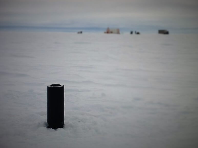
Ice-T is a buoy used at the Ice Camp to measure the thickness of sea ice. Anchored in the pack ice, this device provides information on atmospheric pressure, air temperature, ice drift, horizontal current, temperature, salinity at the base of the ice in addition to thermal profiles of the ice and snow. These data are as accurate (or sometimes more) than those provided by the satellite-derived maps and are drawn up in real time.
Deployment of the Ice-T in numbers :
 May 3, 2016 at 2.44 PM
 GPS location: 67°28.796'N - 63°47,916'O
 Emergence of buoy: 71 cm
 Thickness of the pack ice: 150 cm
 France bord: 3 cm
 Snow depth: 29 cm
A buoyant surface float caught in the ice sheet is equipped for satellite real time data transmission of temperature profiles within the snow and ice layers, as well as measurements of atmospheric pressure and ice drift. Very accurate data on the environment near the ice camp are thus quickly provided to scientists.
A weighted subsurface body (named a fish) in the Arctic ice pack is connected to the buoy by 5-m long cable for transmission of data and energy. The fish is equipped with an upward facing solar altimeter and pressure senor, which makes it possible to measure ice keel draft and subsequently, ice thickness at the Ice camp. Thanks to the fish’s temperature and salinity sensors, we can measure the freezing temperature of the sea water, around the area where de buoy has been placed (30 km from Qikiqtarjuaq) which is a function of its salinity.
From the GreenEdge offices in Qikiqtarjuaq to the pack ice in Baffin Bay offshore of the small community, researchers struggle to produce results to improve our current understanding about the movements of Arctic sea ice.


One thought on “The multi-purpose Ice-T Buoy”